Morse Island – Morse Bridge Projects
Project Overview
The Morse Island – Morse Bridge Projects, located in The Villages, FL, encompass two vital infrastructure endeavors aimed at ensuring safety and sustainability. Managed by CFB Surveying, the project involves monitoring potential erosion on Morse Island and assessing the structural integrity of Morse Bridge.
Background
CFB Surveying initiated the Morse Island project to address concerns regarding erosion. The team established a comprehensive site control network and conducted a topographic survey to establish baseline conditions. Periodic re-surveys were conducted to monitor changes in topography and site conditions, crucial for proactive management.
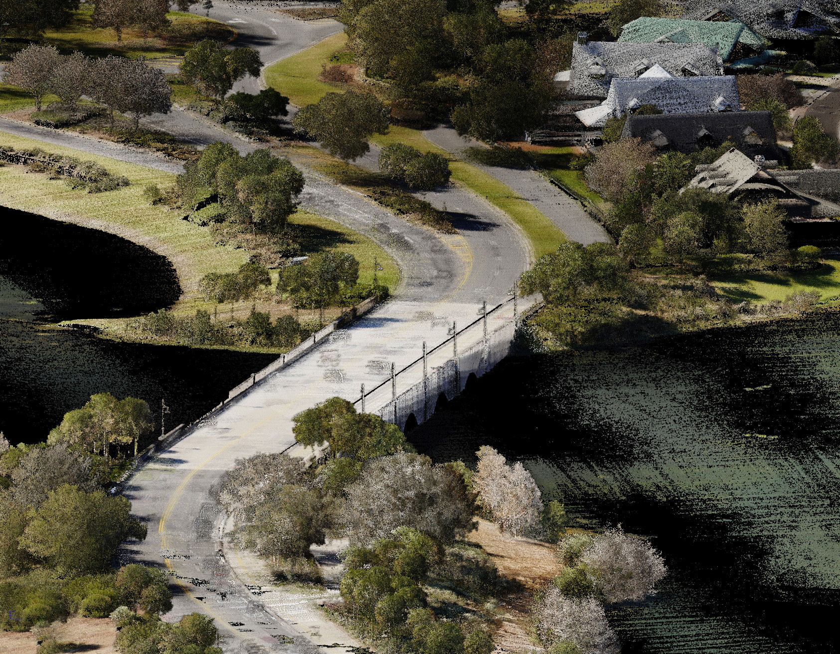
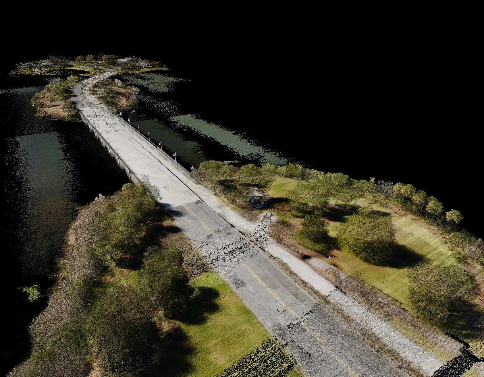
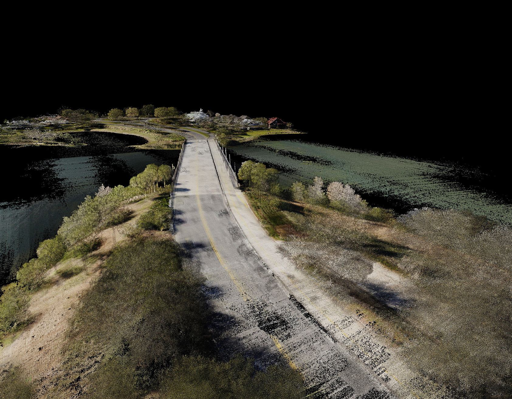
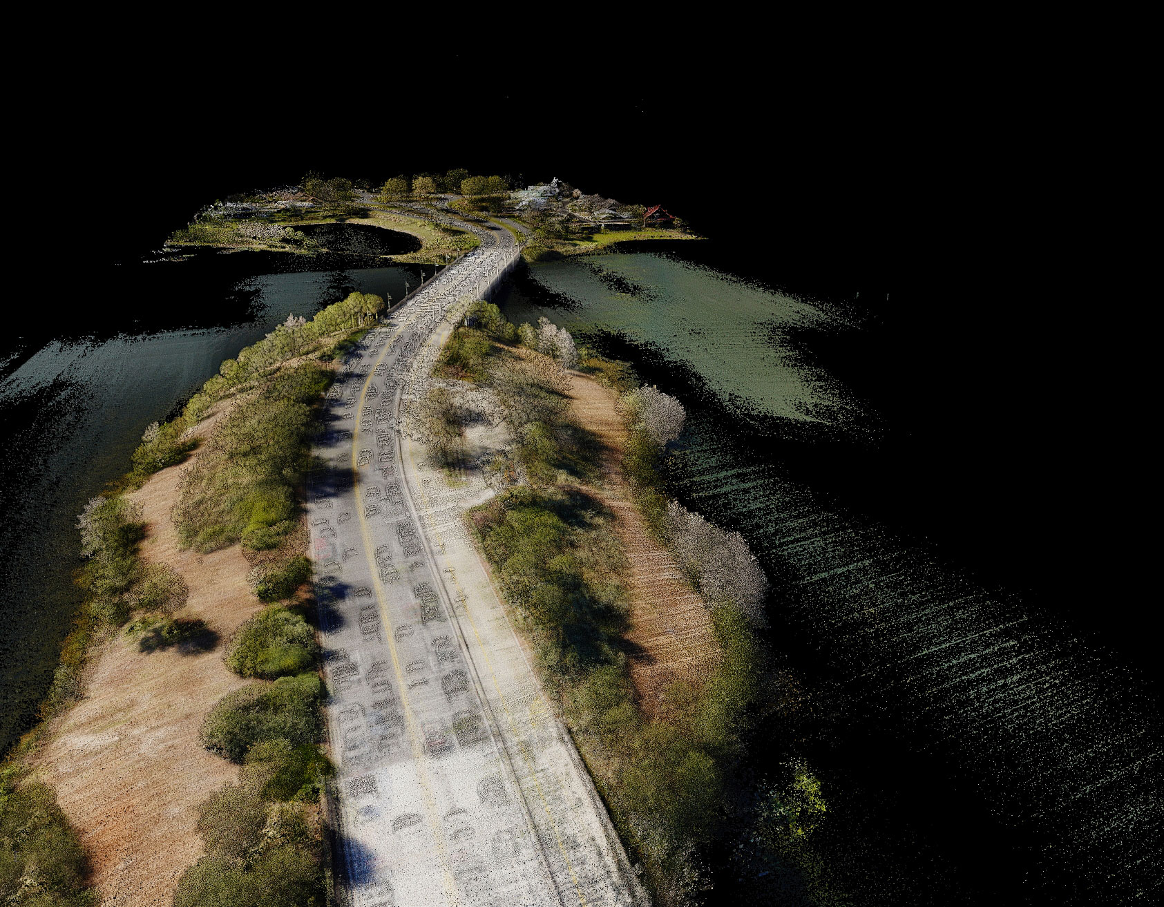
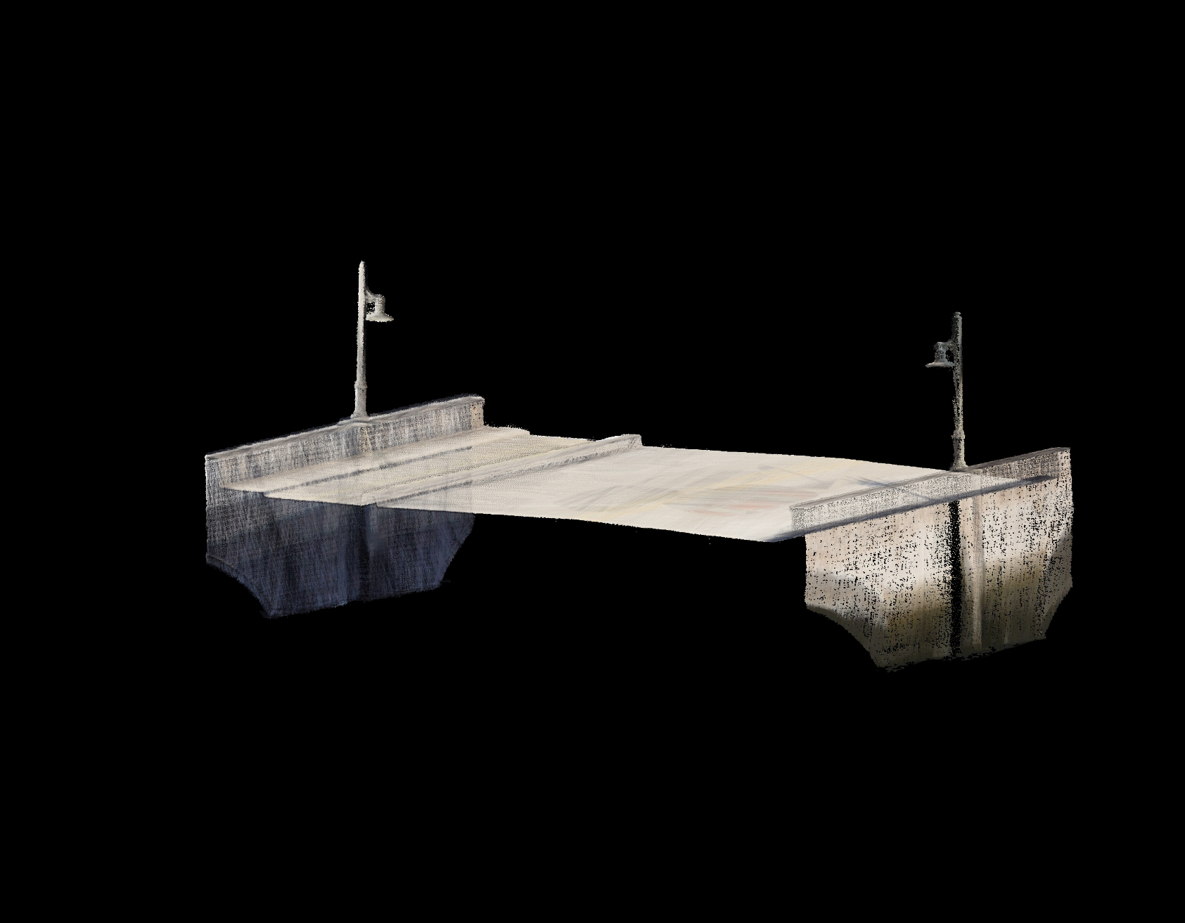
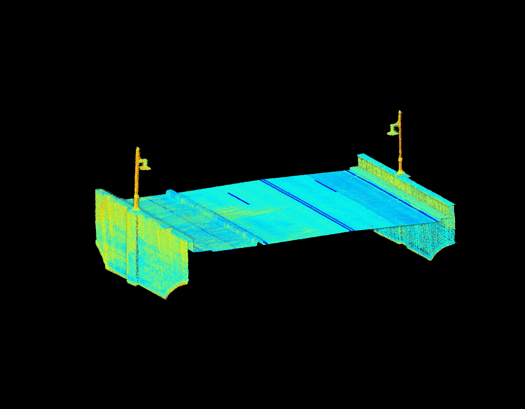
The Morse Bridge, spanning approximately 2500 feet, required thorough assessment due to concerns regarding the structural integrity of its concrete panels. Traditional surveying methods posed safety risks due to high seasonal traffic and constrained workspaces. Additionally, achieving accurate data collection on such a large and complex structure was challenging.
Solution
To overcome site challenges, CFB Surveying, in collaboration with Kimley Horn and Sumter County, integrated geospatial techniques into their conventional workflow. They employed a Harris drone equipped with a Riegl VUX120 Lidar sensor to conduct aerial surveys of the Morse Bridge project site. Flying at an altitude of 300 feet with a lateral strip separation of 50 feet, this approach provided a high point density, ensuring precise data capture.
Implementation
CFB Surveying meticulously planned the drone flights, considering factors such as traffic patterns, airspace regulations, and weather conditions. The drone captured detailed elevation data along the bridge and its extensions, enabling structural engineers to assess lift or settlement of concrete panels accurately.
Outcome
By leveraging geospatial technology, CFB Surveying achieved remarkable results for both projects. The aerial surveys provided comprehensive data on Morse Bridge, facilitating a detailed assessment of its structural condition. This approach not only enhanced safety by minimizing field crew exposure to hazardous conditions but also improved data accuracy and efficiency.
The Morse Island – Morse Bridge Projects exemplify the synergy between traditional surveying methods and geospatial technology. Through proactive monitoring and assessment, CFB Surveying contributes to the safety and longevity of critical infrastructure.
The following photos are point cloud images provided by the CFB Geospatial team.
Project Gallery
CFB Ocala Has a New Home! Learn more about CFB Ocala.